SIRSTUDIO · Earth To Landscape documentation · sirstudiotools.com
Documentation / Earth To Landscape
Earth To Landscape documentation
Choose a real location, import its terrain, then add imagery, roads, buildings or flow maps. This guide covers the main editor workflow.
Before you begin: Use Windows 64-bit and Unreal Engine 5.8; this release was tested with 5.8.3. Terrain imports require a non-World-Partition level. Keep an internet connection available for maps and downloads.
Install and open the tool#
In Unreal, open Edit > Plugins, enable Earth to Landscape, and restart when prompted. Required built-in dependencies are enabled with the plugin, including beta Python and modeling plugins and an experimental modeling toolset.
Open your level, then choose Tools > Earth to Landscape.
1 Find a location#
Enter a place name or latitude and longitude under Find location, then submit the search. Drag the blue area pin to adjust the position. Map and Satellite change the map preview; Satellite does not automatically apply imagery to your terrain.
2 Choose the area size#
Set Side length or use Draw area to define a square. Start with a 1 km area for a first test. The screenshot shows a 3 km square; the larger mountain examples later use 20 km.
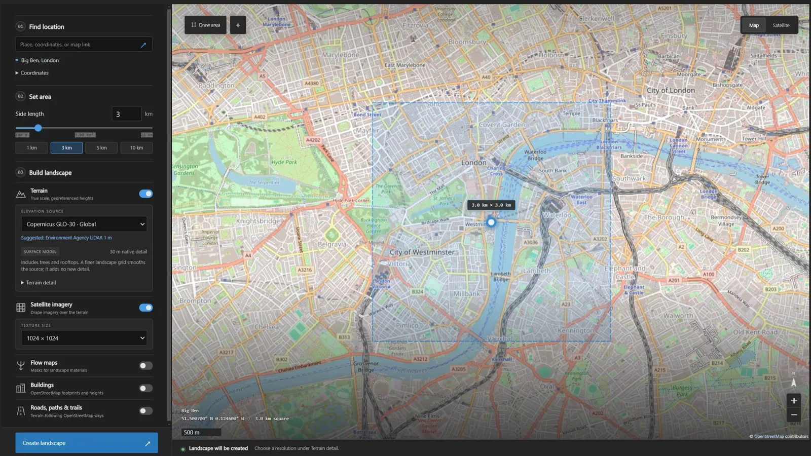
The main interface with a selected area and Terrain and Satellite imagery enabled.
3 Select terrain and imagery#
Under Build landscape, turn Terrain on and select an Elevation source. Copernicus GLO-30 is the global default. Regional LiDAR options offer finer source detail where coverage is available; a suggested source does not guarantee coverage.
Expand Terrain detail. Standard creates a 1009 by 1009 grid; Detailed creates a 2017 by 2017 grid. Existing landscapes keep their current layout. A finer grid uses more memory and cannot invent detail missing from the elevation source.
Turn on Satellite imagery to drape an image over the terrain and choose a texture size. Higher sizes use more memory.
4 Create and inspect the landscape#
Click Create landscape, or Update landscape when a Landscape is connected. Keep Unreal open and pause sculpting until the job finishes. Terrain is downloaded and verified before dependent layers continue. When complete, click Show in viewport to frame the result.
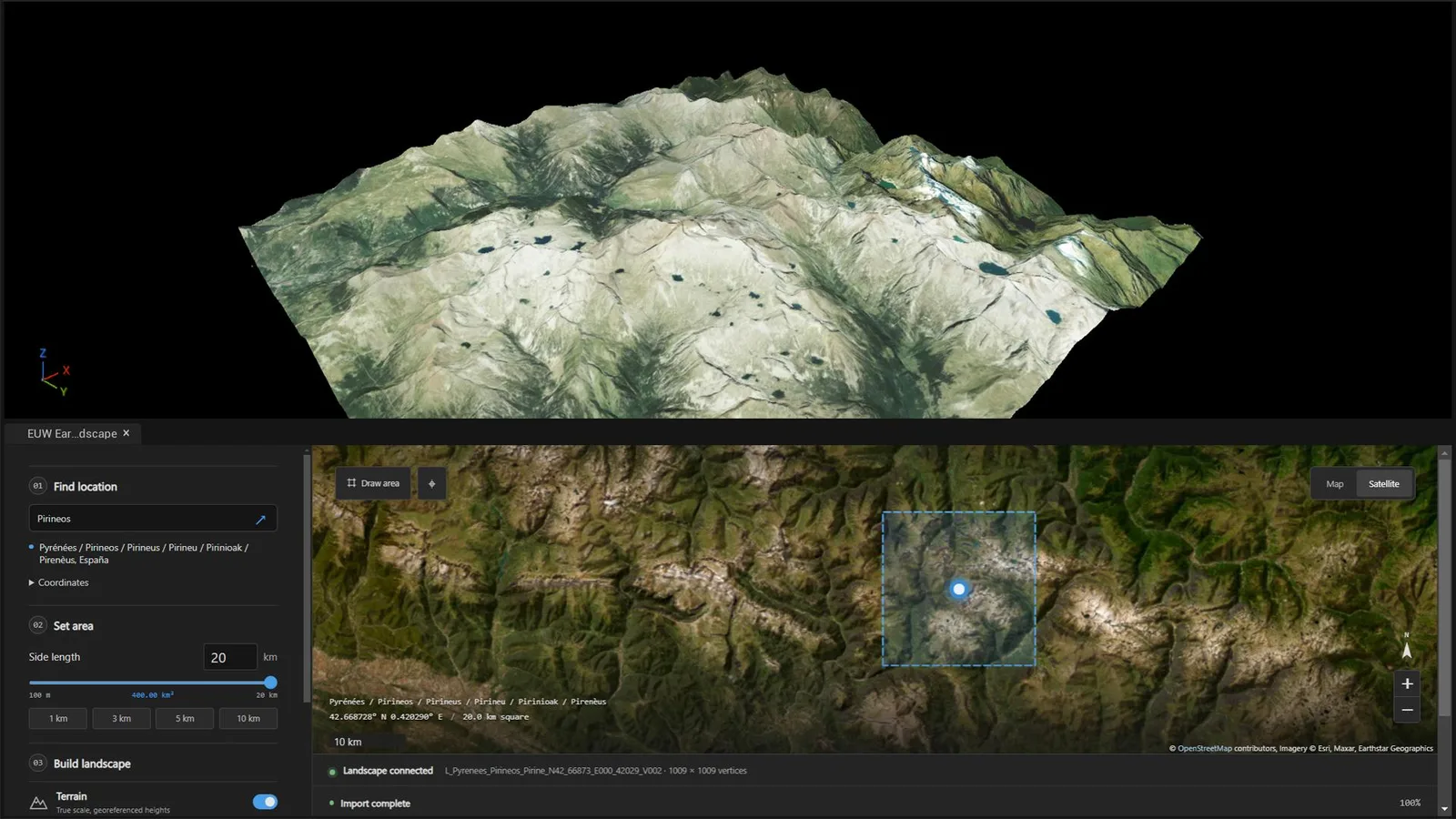
Mountain Landscape with imagery applied. This example uses a 20 km area.
Save your work: Save the level after importing. Generated textures, materials and meshes appear under Content/EarthToLandscape, grouped by terrain and import.
5 Add buildings and roads#
Enable Buildings and/or Roads, paths & trails. Scroll down for their options. These layers use OpenStreetMap data: buildings are approximate extruded footprints, and roads and paths follow the available mapped ways.
To keep imported terrain unchanged, turn Terrain off. Roads and buildings still follow a matching Earth To Landscape terrain. With no Landscape in the level, they use a flat plane. A manually created terrain without geographic metadata cannot be matched automatically.
Merged roads are split into bounded meshes. Dense networks can still consume substantial time and memory; imports above 3 km per side show a road warning. Create editable splines adds editable spline actors, but editing a spline does not automatically rebuild its road mesh. Cut roads into terrain requires terrain and changes the incoming heightmap. Click the main import button to create the selected layers, then wait for completion.
6 Generate flow maps#
Turn Satellite imagery off and Flow maps on, then choose the texture size. Imagery and flow maps cannot be enabled together. For an existing supported Landscape, select only Flow maps and click Generate flow maps. This analyses the current surface without changing its heights.
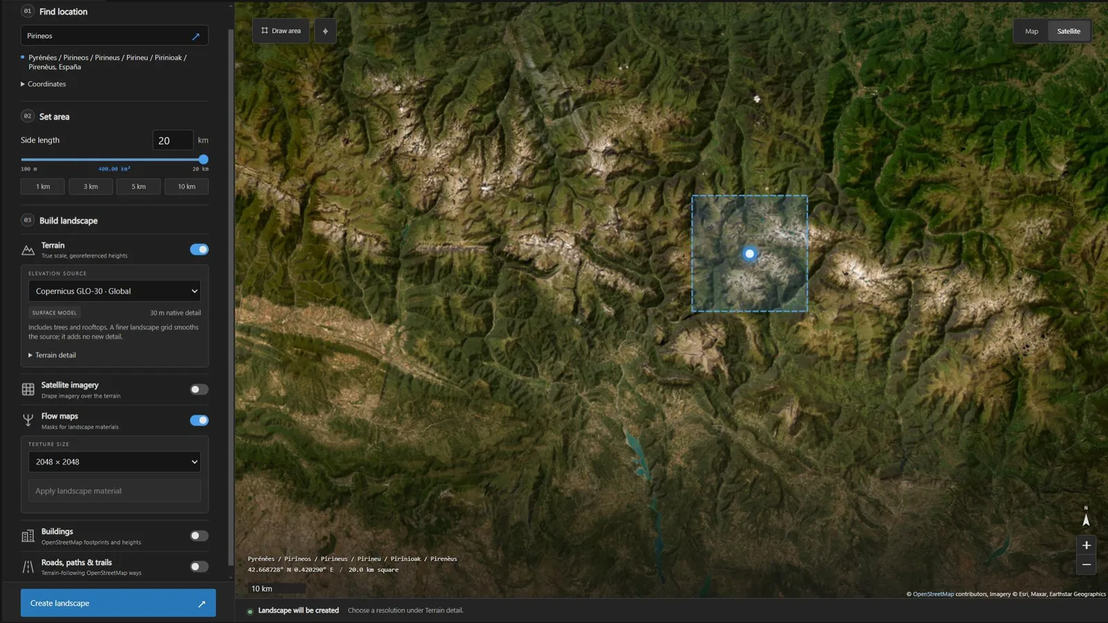
Flow-map settings. The Satellite map preview is separate from the Satellite imagery import toggle.
7 Apply and adjust the landscape material#
In Flow maps, click Apply landscape material to generate masks and assign a material. Use Show textures to find the generated maps and Edit material to adjust the material instance. Assign your own base colour, normal and roughness textures, or set UseTextures off for the Colours mode.
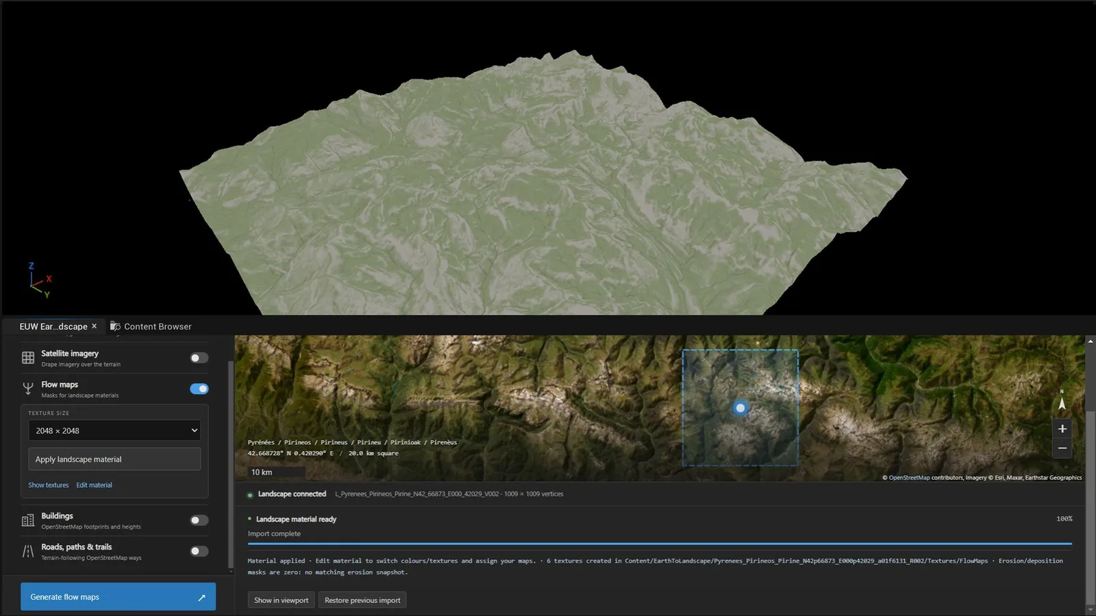
A landscape material applied using the flow-map workflow. You can customize its colours and textures.
Flow maps represent potential drainage, not measured wetness or a live water simulation. Regenerate them after sculpting or road cuts.
Save update and recover#
Save the level after every import or material change. To update an imported area, select its Landscape if the level contains several, open the tool and choose the layers to update.
If a layer fails: Read Import details, resolve the reported issue, then click Retry remaining. Completed layers are reused. Missing provider coverage may require a different source or a smaller area.
To undo the latest import: Use Restore previous import. It retains one previous import state per Landscape, not a full level history. Save the level and preserve Saved/EarthToLandscape/jobs/restore for recovery across sessions.
Support: [email protected]. Include your plugin version, Unreal version and the error message.